In the small town La Fortuna one of the many natural beauties it has to offer, the most recognized attractions are Cerro Chato the creator of Arenal Volcano
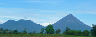 |
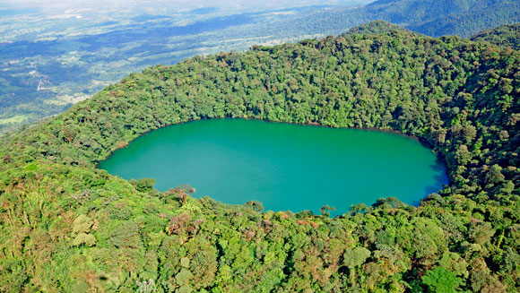 Cerro Chato also know as Chato Volcano is a dormant volcano next to Arenal Volcano that created the Arenal Volcano with explosions material and lava flows accumulated through eruptions. (1.Arenalnet) Cerro Chato height is 3,700 ft tall smaller than Arenal that is 5,437 ft tall. Cerro Chato has two peaks called Chatito, Espina and a crater that become a caldera with a lagoon.(2. Arenalnet)
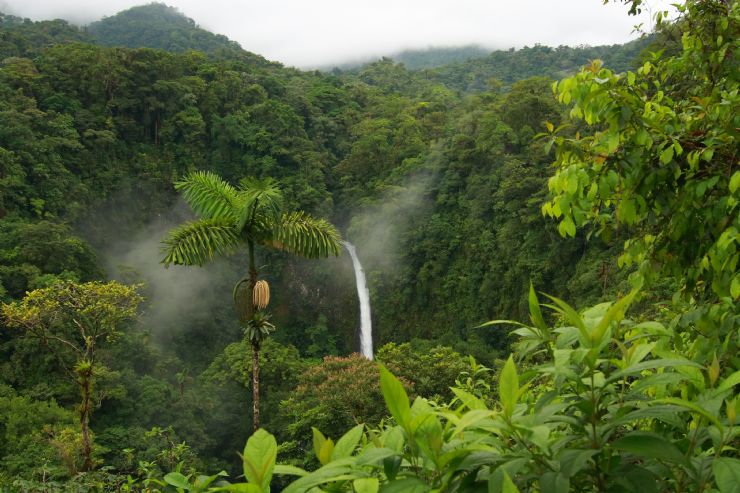
Cerro Chato also help create another beauty of this small town La Fortuna Water Falls.(2)

Arenal volcano became active in 1968 when it had a big explosion destroying three small towns until October of 2010.(1) It’s a composite volcano/ stratovolcano that had explosive eruptions by having a very viscous lava, high amounts of gas under pressure, ash and pyroclastic material.(3) When I visited La Fortuna in 2006 for the whole week I was able to see the smoke coming out of the crater, hot fluorescent tephra flowing down its surface. When I was walking in the jungle I was able to presence an earthquake follow by a small eruption. From 2010 the volcano has been in resting phase not knowing when it will wake up.(2)
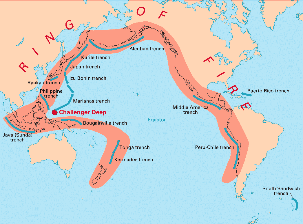 Arenal volcano is one of the youngest volcanoes that is part of the Ring Of Fire were most of stratovolcanoes are found located at convergent plate boundaries.(3)
Sources
- Arenalnet (Arenal): http://www.arenal.net/arenal-volcano-overview.htm
- Arenalnet (Cerro Chato): http://www.arenal.net/tour/cerro-chato-hike/
- News and Information About Geology: http://geology.com/volcanoes/arenal/
- USGS (Convergent plate boundaries) : http://geomaps.wr.usgs.gov/parks/pltec/converge.html
- Image1: http://www.arenalvolcano.com/
- Image 2:http://www.arenalvolcano.com/Free_activities/cerro_chato.html
- Image 3: http://www.govisitcostarica.com/travelInfo/photoLg.asp?phID=952
- Image 4:http://www.costarica-nationalparks.com/arenalnationalpark.html
- Image 5:http://pubs.usgs.gov/gip/dynamic/fire.html
- Image 6:http://geology.com/volcanoes/arenal/